Subject: Ukraine, Crimea
Period: 1736 (dated)
Publication:
Color: Hand Color
Size:
17.6 x 15.1 inches
44.7 x 38.4 cm
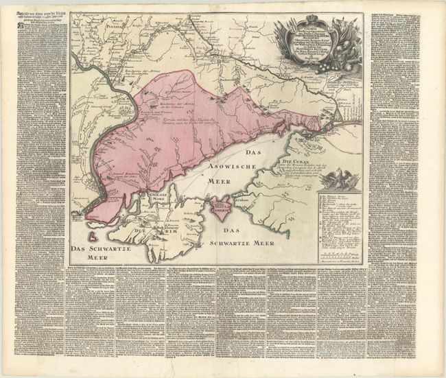
This rare broadside depicts the events of the Russo-Turkish War between March and July 1736. The map shows the theater of war in southern Ukraine, Crimea and the Sea of Azov. The boundary between Russian and Ottoman control is delineated, and the route of the Russian Army in its expedition against the Tartars is depicted, along with fortifications and encampments. The map provides excellent detail of the Ukrainian line - a system of defenses from the Dnieper to the Don Rivers. Seutter based this map on one published by the Academy of Sciences in St. Petersburg for use of the Russian Army, and then added columns of German text surrounding the map that give thorough, almost daily details of the actions between March and July 1736. Full sheet with text measures 26.4 x 22.6".
References:
Condition: B
A dark impression on a bright sheet with light printer's ink residue, minor soiling, and two long professionally repaired tears at top center and in the text at bottom. The edges of the sheet were damaged and professionally replaced with period-correct paper and the image in facsimile, including the top 1/2" of the map and text, and about 1/4" of the text columns on each side of the sheet. The bottom 1" of the text was severed but reattached.