Subject: Switzerland
Period: 1658-1794 (circa)
Publication:
Color: Hand Color
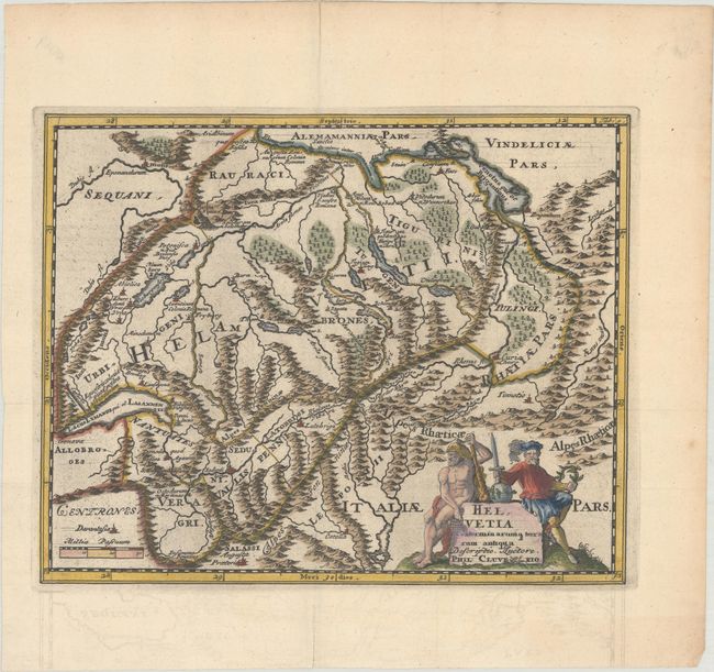
A. Helvetia Conterminarumq Terrarum Antiqua, by Philipp Cluver, from Introductio in Universam Geographicam, published 1697 (9.8 x 7.9"). Attractive small map of ancient Switzerland showing the mountainous topography and classical place names. It is decorated with a figurative cartouche featuring a woodwose.
Cluver's Introductio in Universam Geographicam was a popular atlas, appearing in over 45 editions during a 100-year period. The first edition was published without maps in the 1620s, and the first edition to include maps was published circa 1641. The various editions were published in different cities throughout Europe, including Amsterdam, Nuremberg, and London. This map is from an Amsterdam edition published by Jan Wolters.Reference: Shirley (BL Atlases) T.CLUV-8a #6. Condition: A dark impression issued folding, now flat, on a watermarked sheet with minor offsetting that is mostly only visible in the blank margins.
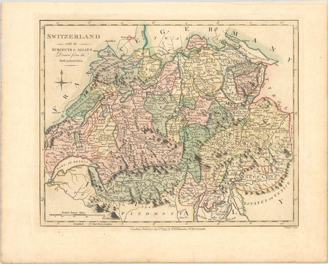
B. Switzerland with Its Subjects & Allies Drawn from the Best Authorities, by Robert Wilkinson, from A General Atlas..., dated 1794 (10.7 x 8.6"). This handsome atlas map divides Switzerland into its cantons. It features excellent detail of the country's many lakes and mountains. A simple compass rose appears beneath the title. Engraved by T. Conder. Condition: Contemporary color with minor soiling. A chip at top right has been archivally replaced with paper.
References:
Condition: A
See description above.