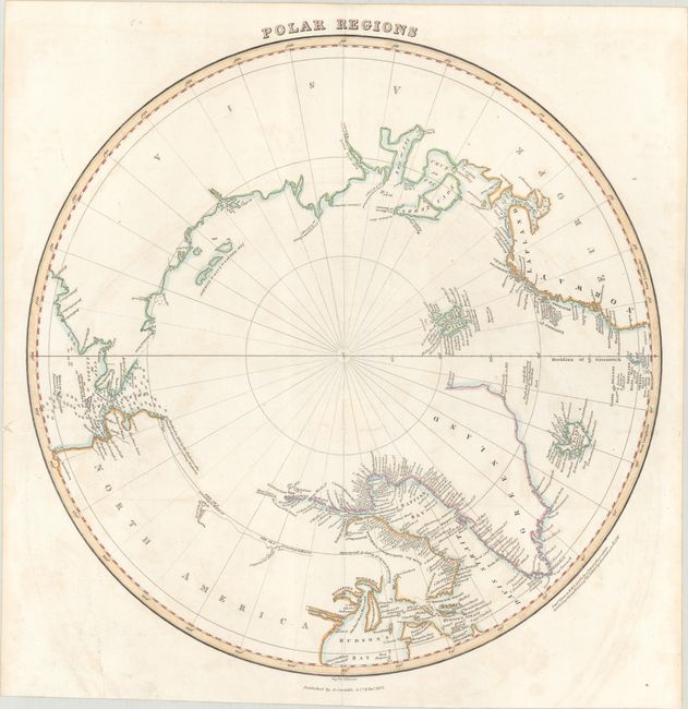
Subject: North Pole
Period: 1822 (dated)
Publication: Lizars' Edinburgh Geographical General Atlas...
Color: Hand Color
Size:
14.9 x 15 inches
37.8 x 38.1 cm
This fascinating and uncommon map of the North Pole shows a region still in the process of being discovered. There is little detail in western Canada beyond a few notes such as The Sea according to McKenzie or The Sea according to Hearne. The intended course of William Parry's contemporary search for a passage on the northwest end of the Hudson Bay is marked with a dotted line. The coasts of Baffin Bay are littered with place names. Bering Strait is filled with depth soundings. Published by A. Constable & Co. in Edinburgh.
References:
Condition: B+
Issued folding on paper with a "A. Cowan 1820" watermark. There is light scattered foxing and offsetting, a faint dampstain across the top edge of the sheet, and a 2" tear around the fold junction that has been closed on verso with old paper.