Subject: Western Belgium
Period: 1734 (circa)
Publication:
Color: Hand Color
Size:
22.8 x 19.6 inches
57.9 x 49.8 cm
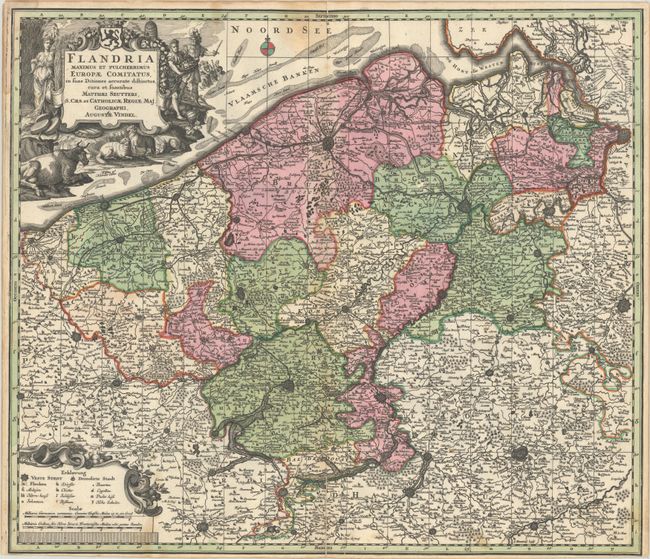
This large copper-engraved map of western Belgium extends to the northern border of France and the southern tip of the Netherlands. The map details the coastline from Grevelingen to Zeeland at de Hont oste Westerschelde, south to below Douay, and east to Brussels. Beautifully engraved and highly detailed, the map shows forests, roads and canals, hundreds of tiny villages and several fortified towns including Brussels and Antwerp. The very decorative cartouche displays the coat of arms of Belgium, Demeter, the goddess of the harvest, and Ares, the god of war.
References:
Condition: B+
A dark impression on a bright sheet with full contemporary color, light toning along the centerfold, a dampstain at top center, and an archivally repaired centerfold separation that enters 2.75" into image at bottom.