Subject: Polar
Period: 1859 (circa)
Publication:
Color: Hand Color
Size:
10.9 x 10.8 inches
27.7 x 27.4 cm
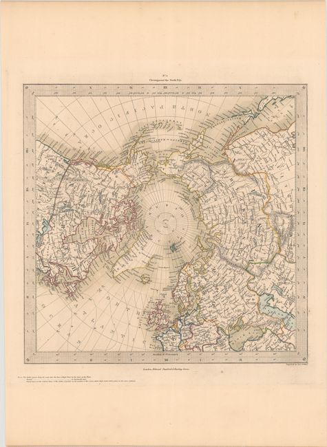
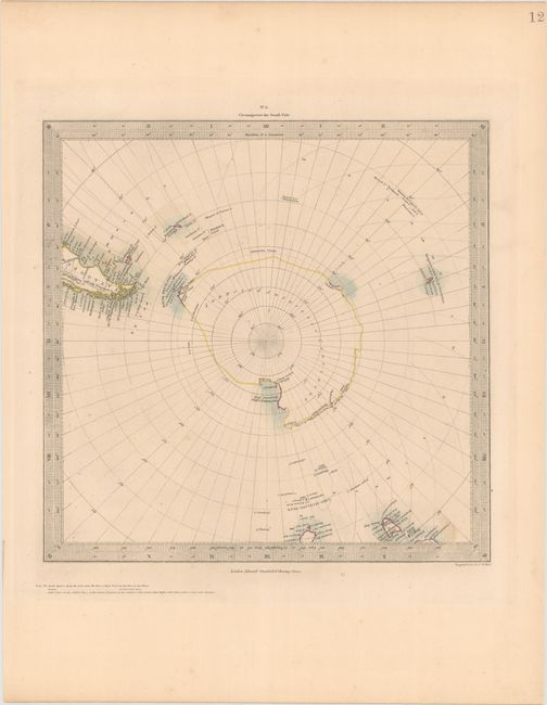
The beginning of the nineteenth century saw a period of rapid market growth and innovation in the map publishing world. Increased literacy and public interest in new frontiers and colonies overwhelmed the market because it was oriented toward the small, affluent market of the previous century. With the intent to fill this void, The Society for the Diffusion of Useful Knowledge (SDUK) was founded in 1828 in London, by Lord Brougham and a group of men dedicated to the education of the aspiring working class and the Utilitarian ideal of 'Knowledge is Power.' The society produced an array of education materials, but the series of maps was one of their most successful ventures. A number of engravers and printers were used to produce the maps, which eventually exceed 200 sheets, and continued to be published after the Society as a whole ceased to function.
These charts were produced to illustrate the newest discoveries at the poles. The northern regions are fairly well mapped by this time with only a few remote coastlines missing or shown by dotted line. On the southern map the South Shetland, Enderly Land, Sabrina Land, La Terre Adele, Balleny and Victoria Land (discovered in 1841) are all delineated within the Antarctic Circle. Engraved by J & C Walker and published by Edward Stanford.
References:
Condition: A
Contemporary color with a few faint spots in the image and a hint of toning in the margins.