Catalog Archive
Auction 184, Lot 477

"'T Graavschap Holland en Sticht van Utrecht Nevens de Voornaamste Delen van Gelderland... ", Specht, Caspar

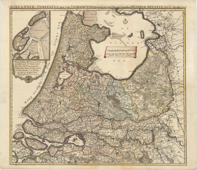
Subject: Netherlands

Period: 1704 (dated)

Publication:

Color: Hand Color

Size:
22.8 x 20.3 inches
57.9 x 51.6 cm
Download High Resolution Image
(or just click on image to launch the Zoom viewer)

A densely detailed map of most of central and western Netherlands, filled with hundreds of roads, towns, and rivers. The inset above the decorative cartouche continues the map along the coastline of the North Sea, including Texel and Vlieland. An alternate Latin title appears above the map: Hollandiae Comitatus una cum Ultrajectino Dominio nec non Maximum Partibus Geldriae Ducatus. A remarkable and rarely seen issue.

References:

Condition: A

A sharp impression on a bright sheet, issued folding and now flattened with professional repairs to a 1.5" tear just below the distance scale and a couple of edge tears in the right blank margin.

Estimate: $400 - $475

Sold for: $300

Closed on 9/15/2021

Archived