Catalog Archive
Auction 184, Lot 467
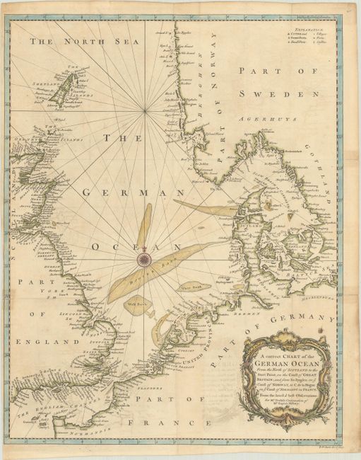
"A Correct Chart of the German Ocean from the North of Scotland to the Start Point, on the Coast of Great Britain; and from So. Bygden on ye Coast of Norway, to C. de la Hogue on ye Coast of Normandy in France...", Seale, Richard William
Subject: Northern Europe, North Sea
Period: 1745 (circa)
Publication: Mr. Tindal's Continuation of Mr. Rapin's History
Color: Hand Color
Size:
14.8 x 18.7 inches
37.6 x 47.5 cm
Download High Resolution Image
(or just click on image to launch the Zoom viewer)
(or just click on image to launch the Zoom viewer)