Subject: London, England
Period: 1892 (circa)
Publication:
Color: Printed Color
Size:
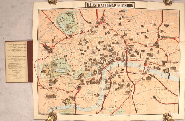
25.8 x 19.4 inches
65.5 x 49.3 cm
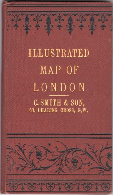
This colorful and decorative map of London extends from Hyde Park (west) to Whitechapel (east) and Islington (north) to Kennington (south). Parks are shaded green, railroad routes are highlighted in red, and numerous important buildings are depicted with a three-dimensional effect including London Tower, St. Paul's Cathedral, Parliament, and Kensington Palace. Complete with original "A Guide to Public Buildings, Theatres, and Places of Amusement" foldout pasted in at front. Hardbound in maroon boards with gilt title on the front cover (4.2 x 7.2"). Circa date is based upon an advertisement on the verso of the foldout guide for "London in 1892" by Herbert Fry.
References:
Condition: A
A mostly clean and colorful example that has been backed with linen. Covers have only minor wear.