Subject: London, England
Period: 1720 (dated)
Publication: A New General Atlas...
Color: Black & White
Size:
22.9 x 19.7 inches
58.2 x 50 cm
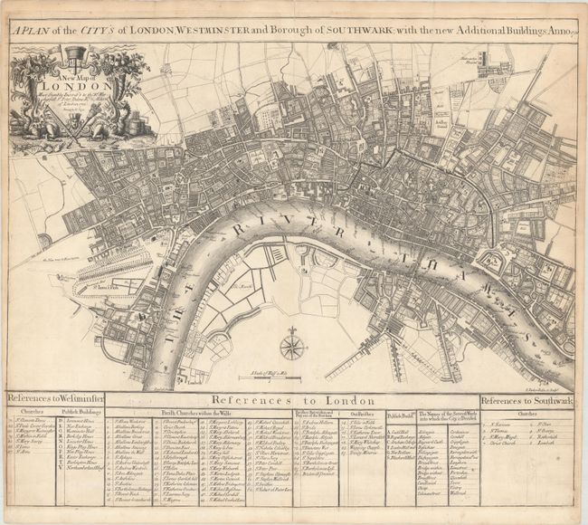
This scarce and detailed plan of London was drawn and engraved by Samuel Parker. The map extends from Buckingham House (west) to Whitechapel (east) and from New River Head (north) to Lambeth (south) with excellent detail of the city's street pattern and individual buildings. Features three keys at bottom locating churches and public buildings on the map. The title cartouche includes a dedication to Sir Peter Delme who was an Alderman in 1720 when the map was made. Delme was extremely wealthy and influential and one of the first homeowner's in London's famed Grosvenor Square. He became Lord Mayor in 1723. Published in 1721 and was the only edition of this atlas.
References: Howgego #65; Shirley (BL Atlases) T.SEN 2a #22.
Condition: B+
A nice impression with short fold separations at top and bottom and a couple of tiny edge tears that have all been closed on verso with archival tape. There is light toning along the sheet edges.