Subject: North Atlantic
Period: 1744 (circa)
Publication: Allerneuster Geographisch- und Topographischer Schau-Platz von Africa und Ost-Indien...
Color: Black & White
Size:
9.9 x 8.8 inches
25.1 x 22.4 cm
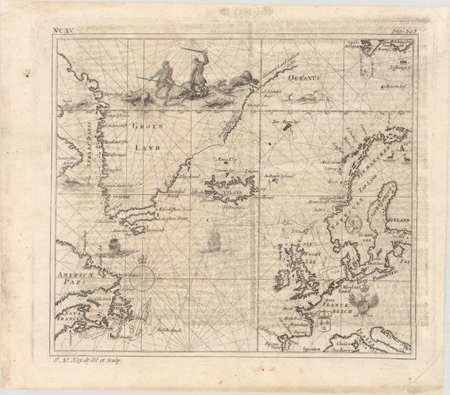
This scarce map covers the North Atlantic from the Davis Strait east to Scandinavia. It extends to include the easternmost parts of Canada, much of Greenland, the British Isles, and the coast of Europe from Galicia, Spain, north to Finland. A violent bear hunting vignette dominates much of Greenland's interior, and there are illustrations of reindeer in Finland. The coats of arms of France, the Holy Roman Empire, and Norway are also depicted inland. Three sea monsters and two ships appear in the ocean, along with a compass rose. Johann Wolfgang Heydt was an surveyor, architect, and engraver under the employ of the Dutch East India Company. He lived in Sri Lanka and then Batavia for much of the 1730s and returned to Europe in 1740 due to health issues. Published by Johann Carl Teschner and the Homann Heirs, Heydt's Allerneuster Geographisch- und Topographischer Schau-Platz von Africa und Ost-Indien... (1744) included plans and maps of VOC settlements in Asia and Africa.
References:
Condition: B+
On paper with a medallion watermark, minor soiling, and offsetting from an opposing page of text.