Catalog Archive
Auction 184, Lot 429

"[Lot of 2] Carte de l'Ocean Occidental Dressee pour Servir a l'Histoire Generale des Voyages [and] Carte de l'Ocean Meridional Dressee pour Servir a l'Histoire Generale des Voyages", Bellin, Jacques Nicolas

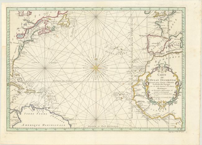
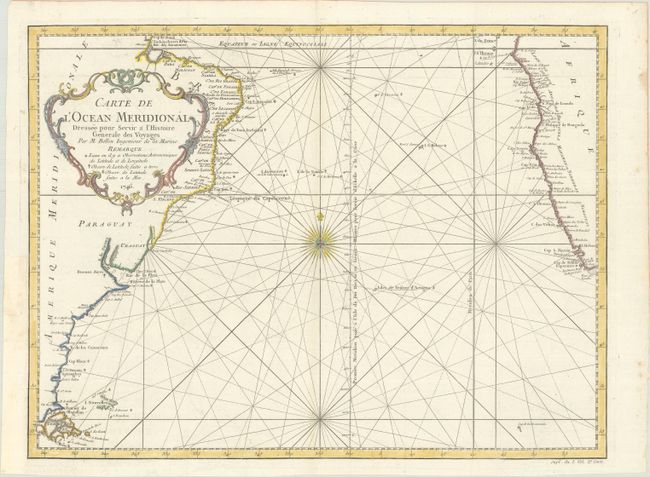
Subject: Atlantic Ocean

Period: 1746 (dated)

Publication: Histoire Generale des Voyages

Color: Hand Color

Size:
18.3 x 12.7 inches
46.5 x 32.3 cm
Download High Resolution Image
(or just click on image to launch the Zoom viewer)

This pair of maps depicts the entire Atlantic Ocean. Each chart is centered on a stunning 32-point compass rose and delineated with rhumb lines. A good portion of the Americas, Europe, and Africa are shown with major port cities named. The coast of North America is labeled with the colonies Florida, Carolina, Virginie, Pensilvanie and Nouve. Angleterre, Ne. Ecosse, and Acadia. The important fishing banks of North America are prominently depicted. The Prime Meridian is shown through I. Ferro with an alternate Prime Meridian shown through Paris.

References:

Condition: A

Bright sheets with a bunch of grapes watermark, issued folding and now flattened, with binding trims at left that have been replaced with old paper.

Estimate: $275 - $350

Sold for: $200

Closed on 9/15/2021

Archived