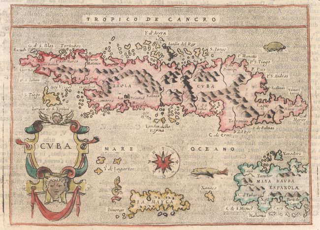
Subject: Cuba
Period: 1713 (published)
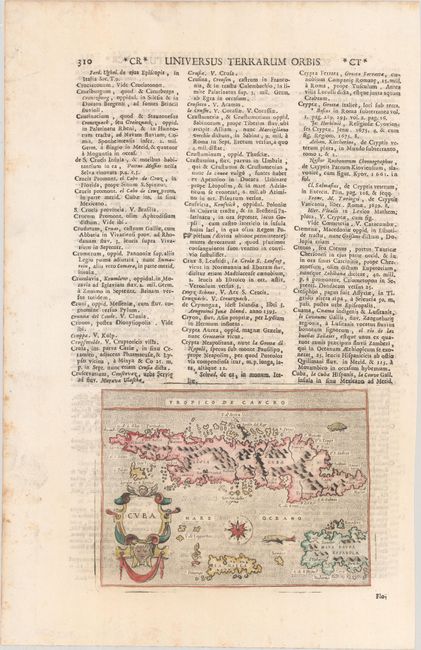
Publication: Universus Terrarum Orbis
Color: Hand Color
Size:
5.7 x 4.1 inches
14.5 x 10.4 cm
This captivating map of the island is based on the cartography of Giacomo Gastaldi. The map includes Jamaica and part of Hispaniola. The Ye de Lagartos, shown north of Jamaica, is one of the earliest references to the Cayman Islands to appear on a map. The map was graphically engraved by Girolamo Porro, with a stipple engraved sea embellished with sea monsters, a sea turtle, a compass rose, and a decorative title cartouche. This map first appeared in one of the most famous Isolarios (Island Books) produced in the 16th century, Tomaso Porcacchi's L'Isole piu Famose del Mondo, which appeared in seven editions between 1572-1686. The plates were then used by Alphonsus Lasor a Varea for his Universus Terrarum Orbis in 1713. Lasor a Varea, whose real name was Raffaello Savonarola, published his two-volume scriptural and historical dictionary with nearly 500 maps that were taken from old plates by Valegio, Porcacchi, Rosaccio-Franco, and Magini, many of which were more than a century old, and often reworked. Printed on a full sheet of Latin text measuring 8.7 x 13.5".
References: Cueto #6; King (2nd Ed.), p. 57-59; Shirley (BL Atlases) T.LAS-1a #155.
Condition: A
On a bright sheet with light foxing along the edges of the sheet.