Subject: Caribbean
Period: 1742 (dated)
Publication:
Color: Hand Color
Size:
23.6 x 17.6 inches
59.9 x 44.7 cm
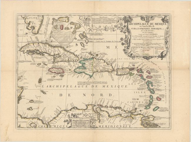
This splendid and uncommon map covers all the West Indies, including the Bahamas and the southern tip of Florida. The partnership of Coronelli and Nolin produced some of the best regional maps of the Americas of the period. The map provides an excellent view of the islands, banks and shoals. The large decorative title cartouche incorporates an extensive key. It is surrounded with fruits, natives, and animals of the islands, including a sea turtle and a flying fish. An elegantly-wrought passionflower vine surrounds the explanation at top, while ginger and indigo adorn the scale of miles at bottom.
References:
Condition: A
Sharp impression with contemporary outline color on a wide-margined sheet with the watermark of a Maltese cross encircled in rosary beads. On verso are light Japanese tissue reinforcements to some extraneous folds, hinge remnants, and a private library stamp.