Subject: World, World War II
Period: 1942-44 (dated)
Publication:
Color: Printed Color
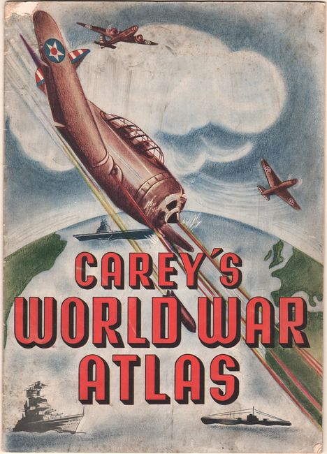
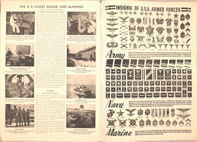
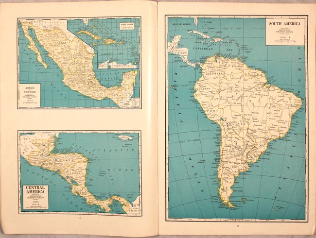
A. Carey's World War Atlas, by the Geographical Publishing Co., published 1942 (10.3 x 14.5"). This wartime atlas contains 25 pages of maps covering the world including "The Atlantic Frontier" locating U.S. Naval and Air bases, a map of the U.S.S.R. showing the eastern front, and a double-page world map. Features a large portrait of General MacArthur on the inside front cover, terms of common usage in the war, sections on the U.S. Army, Navy and Coast Guard and a page showing the insignia of the armed forces. Published Expressly for The Carey Salt Company. Condition: Contents are clean and bright and slightly dog-eared at bottom right. Wrappers are lightly soiled with a small chip in the top left corner of the front wrapper.
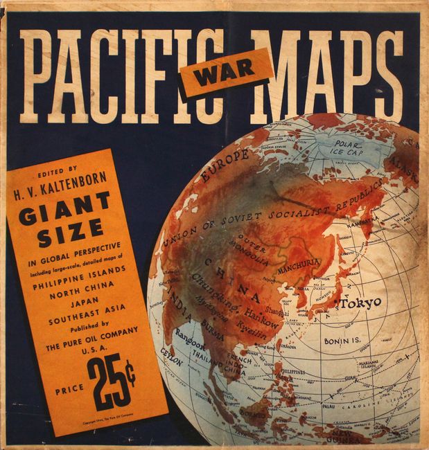
B. Global War in the Pacific, by F.E. Manning, dated 1944 (49.4 x 38.5"). A mammoth map of the Pacific theater of war with countries delineated in vivid color. Legend within the title at top right locates naval bases, air bases, roads, railroads, and the extent of Japanese penetration in the area. Includes two circular insets at bottom. Flags (intact) along right margin were intended to be cut out to show the progress and advances of the Allies. Additional maps on verso including Japan, Northeast China, and the Philippines. Published by the Pure Oil Company. Reference: Rumsey #11572. Condition: Issued folding with a number of splits at the fold junctions, as well as 8" and 2" fold separations at left that have been closed on verso with archival tape. Light soiling to wrappers.
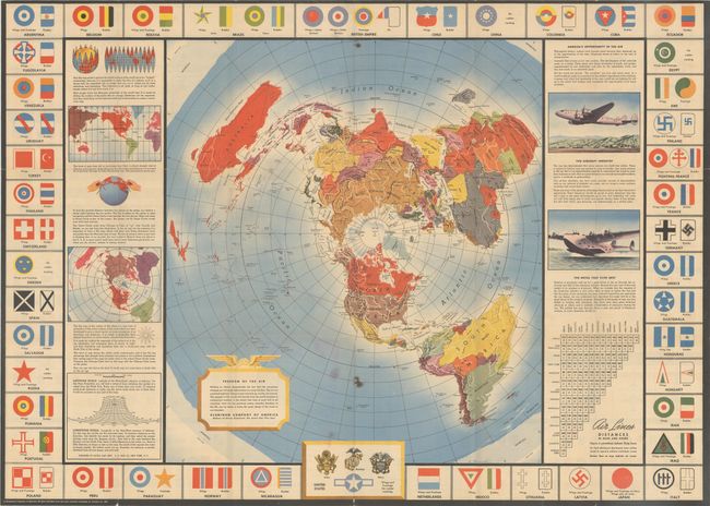
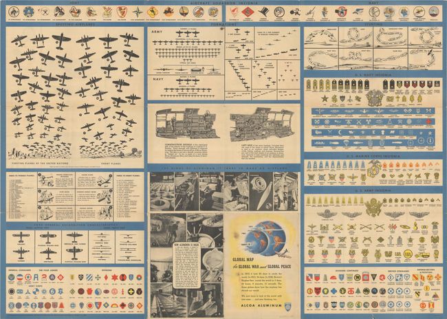
C. Global Map for Global War and Global Peace, by Alcoa Map Dept., dated 1943 (33.4 x 23.9"). This pamphlet contains a very graphic and detailed World War II era map published by the Aluminum Company of America (Alcoa). It was designed on a north polar projection to demonstrate "the fact that the aeroplane changes our old earth-bound ideas as a map like this. The air is a universal highway. Flying routes naturally go across, not around." Flanking the map is text explaining the difference between the commonly seen Mercator projection and the polar projection along with opportunities in the aviation industry. The border includes airplane insignia for various nations (including Nazi Germany), and the verso is filled with additional illustrations including both "friendly" and "enemy" airplanes, plane formations, stunts, and various insignias for the U.S. Army, Navy, and Marines. Reference: Rumsey #6781.003. Condition: Issued folding with a number of tiny splits at the fold junctions and a small burn hole at lower center. Minor color offsetting at bottom.
References:
Condition: B+
See description above.