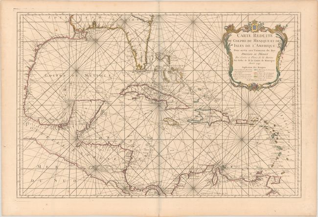
Subject: Gulf of Mexico & Caribbean
Period: 1749 (dated)
Publication: Hydrographie Francoise…
Color: Hand Color
Size:
32.4 x 21.1 inches
82.3 x 53.6 cm
This large, impressive chart of the Gulf of Mexico and the Caribbean shows the Florida Peninsula as a maze of islands. The map was clearly meant to facilitate sailing, with loxodromic lines, the locations of safe anchorages, navigational hazards and the directions of major currents. A lovely cartouche fills the upper right, with the color key underneath. In this edition Bellin's address has been removed from the imprint, but it does not have the seal of the Depot de la Marine or price of the second state and is not noted by Tooley.
References: cf. Tooley (MCC-96) #747.
Condition: A
A dark impression with contemporary outline color in the map and later color in the cartouche, printed on sturdy paper with a large double-headed eagle watermark. There is minor offsetting, a few spots of foxing, and a tiny centerfold separation along the bottom edge of the sheet.