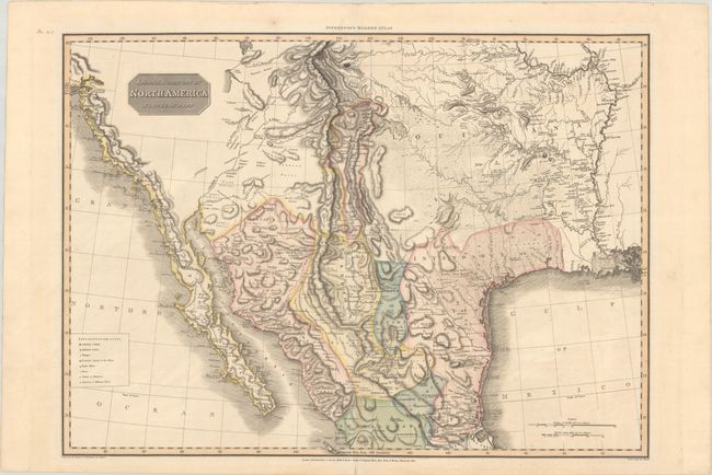
Subject: Southern United States & Mexico
Period: 1811 (dated)
Publication: A Modern Atlas
Color: Hand Color
Size:
27.6 x 19.9 inches
70.1 x 50.5 cm
This large handsome map is based primarily on Humboldt's map of Mexico, including the graphic representation of the Rocky Mountains and Rio Grande River valley. The map presents a remarkable, emerging picture of the major watersheds originating in the Rocky Mountains - a region long misrepresented on maps of the region. On the western slope, the headwaters of the Colorado are formed and the erroneous Sr. de S. Buenaventura flows into a partially shown Salt Lake. On the eastern part of the map the Platte, Arkansas and Red Rivers are all delineated in great detail, and the course of the R. Bravo or Del Norte (Rio Grande) is equally well presented with mountains depicted by hachures in orthographic projection. Further south, the mouth of the Gila is inaccurately placed in the Gulf of California. The map also presents early information in Texas, which is within the Intendancy of S Louis de Potosi. The Pres. de Bejar, Capitol of the Province of Texas is located, as is the settlement of La Salle in 1683, and the Presidio of Nacogdoch. The map is also filled with information on Indian tribes, mines, farms, missions, military posts, roads and Stations of Muleteers.
References: Phillips (Atlases) #724-43.
Condition: A
Contemporary color on a clean bright sheet. There are remnants of hinge tape on verso.