Subject: Virginia
Period: 1796 (published)
Publication: The American Universal Geography
Color: Black & White
Size:
7.6 x 5.8 inches
19.3 x 14.7 cm
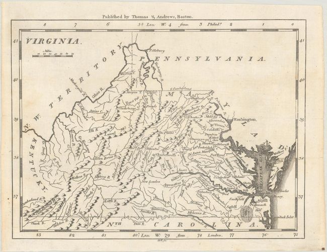
This map of Virginia is nearly identical to the maps of Barker and Scott, but here the western boundary is not shown on either the eastern or western fork of the Big Sandy River. It features fine topographical detail and names several towns and cities, including Washington (not yet the District of Columbia), Richmond, Charlotteville, and, outside the state, Pittsburg. Ohio is still N.W. Territory. Onancock is labeled Onaucook, again a similarity to the Barker and Scott maps. Published by Thomas & Andrews and engraved by Samuel Hill.
References: McCorkle (18th C. Geography Books) #304-12; Wheat & Brun #571.
Condition: A
Issued folding with a few faint spots and professional repairs to a couple of tiny edge tears that are confined to the blank margins.