Subject: Texas
Period: 1855 (dated)
Publication:
Color: Hand Color
Size:
26.1 x 16.9 inches
66.3 x 42.9 cm
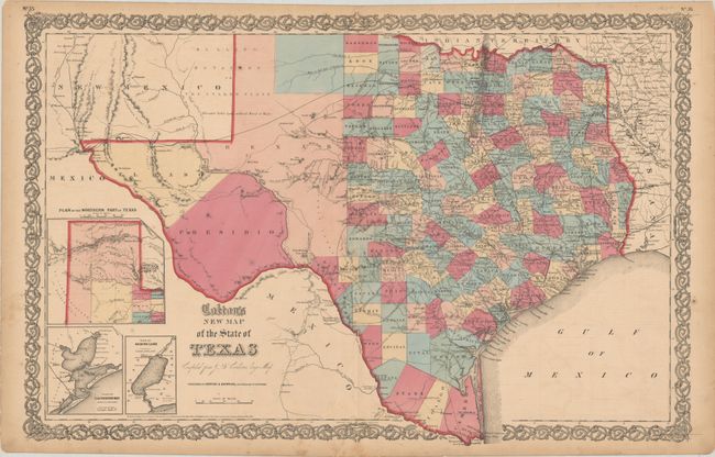
This double-page map shows extensive detail throughout the settled part of the state. The western third is comprised of the large unsettled areas of Presidio, El Paso, Bexar and the Staked Plain. Locates railroads, forts, post offices, roads, springs, and topographical detail. Includes three inset maps: Plan of the Northern Part of Texas, Plan of Galveston Bay from the U.S. Coast Survey, and Plan of Sabine Lake. Surrounded by Colton's decorative scroll borders. Dated 1855 but published in 1862.
References:
Condition: B
Full contemporary color with a 12" centerfold separation that has been closed on verso with archival tissue. There is some light offsetting, minor soiling, and a few short edge tears confined to the margins.