Subject: Port Royal, South Carolina
Period: 1732 (circa)
Publication: Atlas Minor
Color: Hand Color
Size:
10.6 x 7.8 inches
26.9 x 19.8 cm
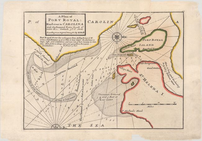
This map shows the proposed fort on St. Helena Island, Hilton Head, and Bauford Town on Port Royal Island, as well as numerous soundings and an anchorage in the harbor. A note below the title explains that the harbor is safe and provides access to "ye best Country in Carolina." Off-shore from Hilton Head is Uncertain Ground with a large area of sea-bed that is All Dry at Low-water. East of Elizabeth is the location of another proposed fort, most likely the future Fort Fremont. The map includes a simple title block, rhumb lines, and two compass roses that orient the north to right.
References: Cumming (SE) #200; Phillips (A) #578-52.
Condition: B
A crisp impression with old outline color on a sheet with a fleur-de-lis watermark. There are a few tiny repaired cracks caused by oxidation of green pigment, some minor offsetting, and several repaired edge tears, one of which enters the map image at top.