Subject: Oklahoma
Period: 1899 (published)
Publication: H.R. Doc. 5, 56th Congress, 1st Session
Color:
Size:
5.9 x 9.3 inches
15 x 23.6 cm
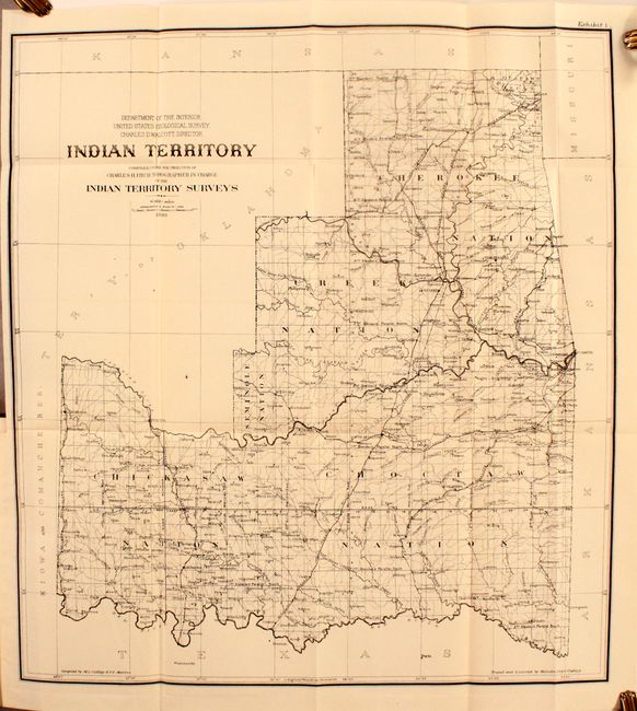
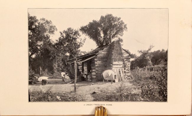
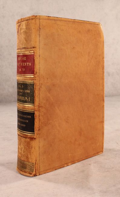
This is the sixth annual report of the Commission to the Five Civilized Tribes, with additional reports by the Indian Inspector to the Indian Territory, Board of Indian Commissioners, and an extensive listing of proposals received and contracts awarded for the Indian Service. The volume is well-illustrated and contains numerous plates, tables, and 5 maps. Of particular interest is the map of Indian Territory (18.0 x 20.0") by Charles Fitch which matches the configuration of the rare State of Sequoyah, which the Indian Nations attempted to create in 1905 in an effort to thwart the expansive tendencies of the United States. It is also similar to the rare 1896 Senate edition which was issued in printed color. The regions of the Chickasaw, Choctaw, Creek, Seminole, Cherokee, and several other Indian tribes are named. The Territory of Okalahoma hovers ominously in the northwest. Fitch was the topographer in charge of the Indian Territory Surveys. The full listing of maps in the volume include:
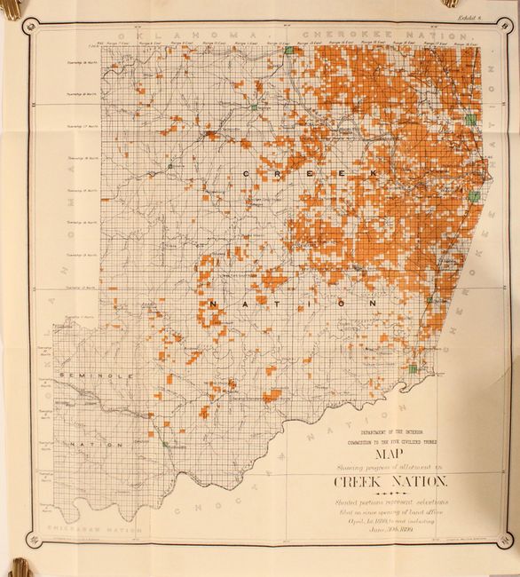
A. Map Showing Progress of Allotment in Creek Nation, dated 1899, printed color (17.9 x 19.3").
B. Fractional Township No. 15 North Range No. 18 East of the Indian Meridian, Indian Territory, dated 1899, black & white (12.0 x 11.6").
C. Township No. 16 North Range No. 22 East of the Indian Meridian, Indian Territory, black & white (12.0 x 11.6").
D. Sec. 9. T.15N., R 18 E. Indian Territory, black & white (6.0 x 6.0").
E. Indian Territory, dated 1898, black & white (18.0 x 20.0").
743 pages. Hardbound in contemporary leather with title labels on the spine.
References:
Condition: B+
Maps and plates are clean and bright. The map of the Creek Nation has a 1.5" binding tear at right that has been closed on verso with archival tape. Text is lightly toned and the front endpaper is loose. Hinges are starting and the covers are scuffed and worn.