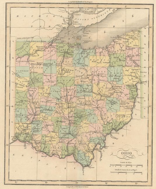
Subject: Ohio
Period: 1825 (published)
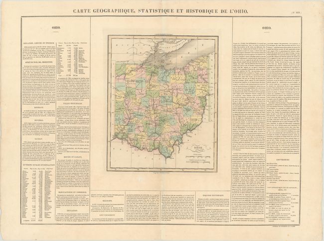
Publication: Atlas Geographique, Statistique, Historique ... des Deux Ameriques
Color: Hand Color
Size:
9.4 x 11.6 inches
23.9 x 29.5 cm
This informative map of Ohio shows early settlements, county development (current to 1820), and the road network. Numerous forts are located in the western part of the state among several Indian reservations. The boundary with Michigan is still in dispute with both claims shown. Panels of French text at the sides and bottom include an interesting table listing the 59 counties (versus 88 today) with their populations in 1810 and 1820; the population of the state more than doubled in this ten year span. The size given is for the map only; it is on a large folio sheet measuring 27.3 x 20.4". Buchon produced the French edition of Carey & Lea's American Atlas. He used a better quality paper and today his maps are generally found in better condition than their American counterparts.
References: Phillips (Atlases) #1176-30.
Condition: A
Contemporary color with minor scattered foxing and a short centerfold separation in the bottom blank margin.