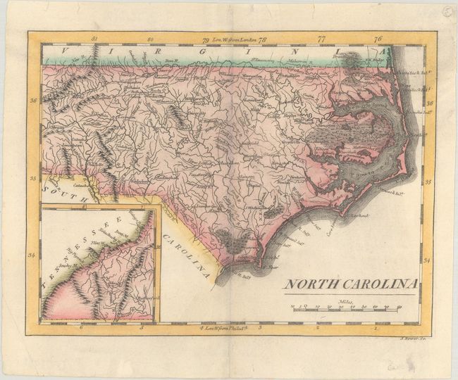
Subject: North Carolina
Period: 1814 (circa)
Publication: American Pocket Atlas
Color: Hand Color
Size:
7.4 x 5.6 inches
18.8 x 14.2 cm
Mathew Carey was a seminal figure in early American publishing; establishing the first publishing firm to specialize in cartography and issuing the first atlas devoted exclusively to American maps. He set up an elaborate cottage system of craftsmen for compiling, engraving, printing, and coloring maps. This practice was emulated by later American cartographic publishers such as John Melish and Henry S. Tanner. The American Atlas concept was also adopted by other publishers in both the United States and Europe.
This early map of the state details settlements, watersheds, topography, and the extensive wagon road system of the day. Locates many swampy areas along the coast including the Great Dismal Swamp, Alligator Swamp, and the Great Green Swamp. At lower left is an inset map of the western portion of the state. Engraved by J. Bower.
References:
Condition: B+
On a bright sheet with professional repairs to a couple of small centerfold separations and tiny edge tears confined to the top blank margin.