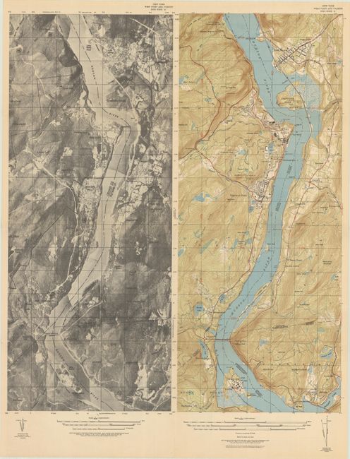
Subject: West Point, New York
Period: 1942 (dated)
Publication:
Color: Printed Color
Size:
17.8 x 21.1 inches
45.2 x 53.6 cm
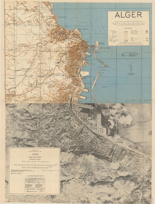
This interesting sheet shows two maps, side by side, with the same title (each 8.9 x 21.1"). The left map presents an aerial view of the region from Stony Point north to Cold Harbor, while the right map shows the topographical features with individual buildings located at West Point. The verso contains a map of Algeria Alger and Vicinity Uncontrolled Mosaic (24.0 x 17.3") also with both an aerial and topographical perspective. This wartime map was likely not widely distributed with no past sales results located.
References:
Condition: A
Issued folding on a clean sheet with an extraneous crease at lower right.