Subject: Michigan
Period: 1842 (circa)
Publication: A New Universal Atlas
Color: Hand Color
Size:
10.6 x 12.5 inches
26.9 x 31.8 cm
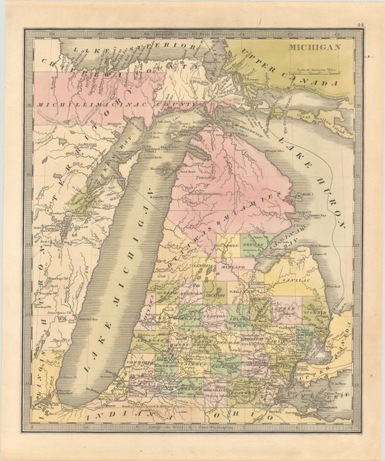
This uncommon map of Michigan features a narrow, backward sloping configuration for Lake Michigan which is based upon Aaron Arrowsmith's map of 1802. The upper regions are not organized but are loosely arranged into the Ottawas & Miamies area, the Township of Michillimacinac and Michillimacinac County in the Upper Peninsula. To the south of this region, 37 counties are delineated and named. Michigan's claimed southern boundary extends to nearly the southern tip of Lake Michigan, well within Indiana's boundaries.
References: Phillips (Atlases) #784-44; Karpinski #152.
Condition: B+
Full contemporary color on a sheet with very light toning.