Subject: Boston, Massachusetts
Period: 1867 (published)
Publication:
Color: Black & White
Size:
35.7 x 28.8 inches
90.7 x 73.2 cm
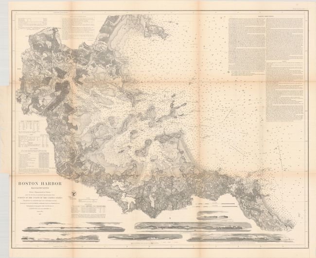
The Office of Coast Survey is the oldest U.S. scientific organization, dating from 1807 when Congress directed that a "survey of the coast" be carried out. By 1836, it was called the U.S. Coast Survey and in 1878, the name was changed to the U.S. Coast and Geodetic Survey. Today the Office of Coast Survey is a division of the National Oceanic and Atmospheric Administration NOAA.
The survey teams, composed of civilians as well as Army and Naval officers, charted the nation's waterways and produced a wide array of reports, survey charts, hydrographic studies of tides and currents, astronomical studies and observations, and coastal pilots. These charts are an important record of the changing nature of the nation's coastlines. In additional to coastal charts, the U.S. Coast and Geodetic Survey produced land sketches, Civil War battle maps, and the early aeronautical charts.
This is one of the finest charts produced by the Coast Survey, fully and beautifully engraved with as much detail on land as along the coastline. The chart is filled with hundreds of soundings, anchorages, hazards, bottom types, and tables of buoys, light houses, and tides. The inland detail includes roads, houses, fields, villages and railroads. Lengthy notes provide sailing directions. Six sea view elevations show the land from various approaches.
References:
Condition: B
Issued folding with some light toning along the fold lines and a number of small separations mostly at the fold junctions.