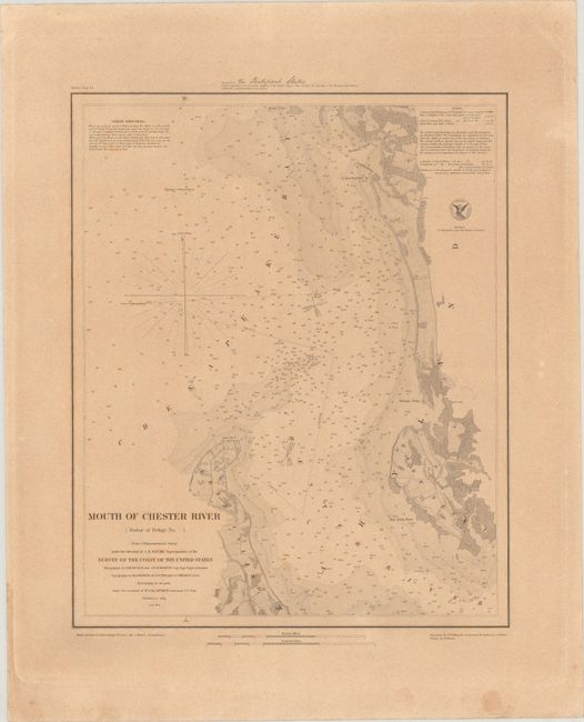
Subject: Chester River, Maryland
Period: 1849 (dated)
Publication:
Color: Black & White
Size:
14.1 x 17.2 inches
35.8 x 43.7 cm
This detailed chart focuses on the wide mouth of the Chester River, a major tributary of the Chesapeake Bay in Maryland. The chart is filled with navigational information, including depth soundings, bottom types, sailing directions, notes on the tides, and more. There is fine topographical detail along the coasts of Kent Island and Eastern Neck, now a national wildlife refuge. From the trigonometrical survey under the direction of A.D. Bache, Superintendent of the Survey of the Coast of the United States. Triangulation by J. Ferguson and J.E. Johnston; topography by H.L. Whiting, R.D. Cutts, and J.C. Neilson; and hydrography under the command of W.P. McArthur. Final reduction for engraving by William Luce and C. Mahon; engraved by F. Dankworth, O.A. Lawson, W. Smith, and S.T. Pettit.
This is a very early example printed on heavy paper and appears to have been a special copy presented to the "Pontifical States," as written in manuscript above the map. Also known as the Papal States, the Pontifical States were territories in Italy under the sovereign rule of the pope, originally established in the 8th century. The United States officially established diplomatic relations with the Pontifical States in August 1848, not long before this chart's publication date.
References:
Condition: B+
On a sturdy, thick sheet with light toning, scattered foxing, and a crease in the top right corner.