Subject: New Orleans, Louisiana, Civil War
Period: 1862 (published)
Publication: Sen. Ex. Doc. 56, 37th Congress, 2nd Session
Color: Hand Color
Size:
5.6 x 8.9 inches
14.2 x 22.6 cm
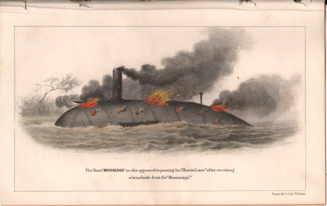
This uncommon report discusses the capture of Fort Jackson and St. Philip, which led to the capture of the city of New Orleans (the largest city in the confederacy). The two confederate forts located across the Mississippi River from each other were key to keeping New Orleans in Confederate hands. Once they fell to Farragut's fleet, New Orleans was lost. The report is accompanied by 3 maps and two colored plates of the Ram Louisiana and the Ram Manassas, both Confederate ships. The 3 folding maps include:
A. Plan of Fort Jackson, Showing the Effect of the Bombardment by the U.S. Mortar Flotilla and Gunboats April 18th to 24th 1862 (16.8 x 10.6").
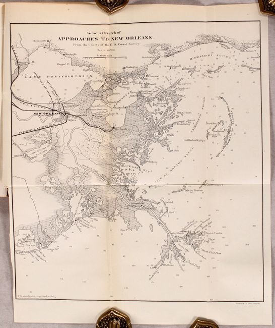
B. General Sketch of Approaches to New Orleans. From the Charts of the U.S. Coast Survey (11.5 x 12.9").
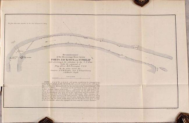
C. Reconnoissance of the Mississippi River Below Forts Jackson and St. Philip Made Previous to the Reduction by the U.S. Fleet Under the Command of Flag Officer D.G. Farragut, U.S.N... (16.8 x 9.1").
107 pages. Disbound and housed in archival paper covers with handwritten label.
References:
Condition: A
Maps, plates and text are mostly clean and bright with some minor foxing to the Reconnoissance map.