Catalog Archive
Auction 184, Lot 289

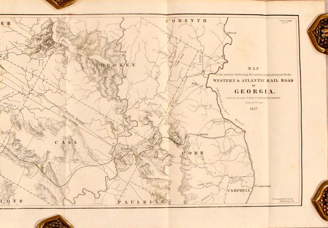
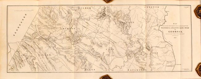
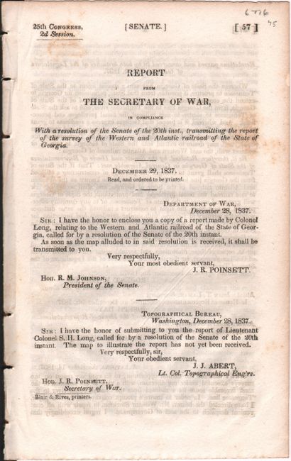
"Map of the Country Embracing the Various Routes Surveyed for the Western & Atlantic Rail Road of Georgia [in] Report from the Secretary of War ... Survey of the Western and Atlantic Railroad of the State of Georgia", U.S. Government

Subject: Georgia

Period: 1837 (published)

Publication: Sen. Doc. No. 57, 25th Congress, 2nd Session

Color: Black & White

Size:
21.4 x 7.6 inches
54.4 x 19.3 cm
Download High Resolution Image
(or just click on image to launch the Zoom viewer)

According to Modelski this is the earliest printed railroad map residing in the collection of the Library of Congress that was based on government surveys. The map was surveyed and drawn by M. M. Stansbury of the U. S. Topological Bureau. When the route was completed in 1850, it ran 138 miles between today's Atlanta (then called Terminus) and Chattanooga. Its strategic location made it a key supply route for the Confederacy and was the track for the famous 'Andrew's Raid' in 1862 when Union soldiers captured the locomotive General. A most desirable and early railroad map. Disbound and housed in archival paper covers with handwritten label.

References: Modelski (Railroads First 100 Years) No. 6 (illustrated); Modelski #613; Claussen & Friis # 181.

Condition: B+

There is light scattered foxing that is more prominent in the disbound text than the map.

Estimate: $150 - $180

Sold for: $300

Closed on 9/15/2021

Archived