Subject: Florida
Period: 1784 (circa)
Publication: Recueil d'Estampes Representant les Differents Evenemens
Color: Black & White
Size:
6.7 x 4.9 inches
17 x 12.4 cm
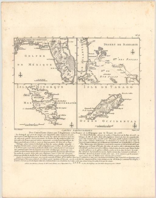
These four small maps on a single sheet represent British possessions that were handed over to Spain and France as a result of the Treaty of Paris. The territories of East and West Florida and Minorca were given to Spain while France gained Tobago and Senegal. The map of Florida is shown with a northern border at 31 degrees latitude, about half a degree farther north than its present border. A huge area along the east coast is shown as swamp, most likely a misplaced Everglades. Each of the maps show only a few place names and basic topography.
The map appeared in Nicolas Ponce and Francois Godefroy's Recueil d'estampes representant les differents evenements de la guerre qui a procure l'independance aux Etats unis de l'Amerique. This was the first French publication to name the United States in its title. On a sheet of French text measuring 8.0 x 10.25".
References:
Condition: A
A crisp impression with some faint foxing mostly in the blank margins.