Subject: Los Angeles, California
Period: 1917 (dated)
Publication:
Color:
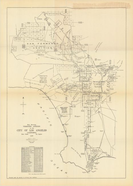
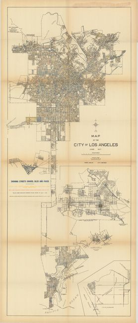
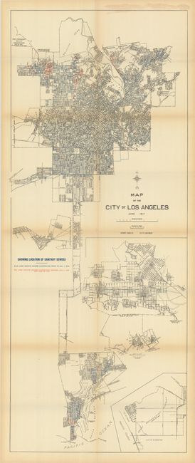
Three maps showing the evolving infrastructure of Los Angeles in 1917 as it attempted to deal with a population explosion from 100,000 in 1900 to 550,000. Each map folds onto a small sheet with a printed map title:
A. Map Showing Territory Annexed to the City of Los Angeles California, by Homer Hamlin, black & white (12.6 x 17.9"). This map demonstrates how the city's footprint grew through a series of annexations from 1869-1917, with the Owensmouth and West Coast annexations occurring in 1917.
B. Map of the City of Los Angeles - Showing Streets Graded, Oiled and Paved, printed color (15.5 x 38.1"). This large map is color-coded to show the status of roads in 1917. Road types identified include graded and oiled in 1917 (yellow), paved in 1917 (red), previously graded and oiled (brown), and previously paved (blue). Includes insets of the San Fernando Valley and West Coast annexation.
C. Map of the City of Los Angeles - Showing Location of Sanitary Sewers, printed color (15.4 x 38.0"). Identical to the base map above showing the status of sewer construction with blue lines indicating construction prior to July 1, 1916 and red lines constructed between July 1, 1916 and June 30, 1917.
References:
Condition: B+
Issued folding on thin paper with light toning along the fold lines. The second map (streets graded, oiled and paved) has a long horizontal fold separation that has been closed on verso with archival tape.