Subject: World
Period: 1817 (dated)
Publication:
Color: Hand Color
Size:
18.4 x 11.1 inches
46.7 x 28.2 cm
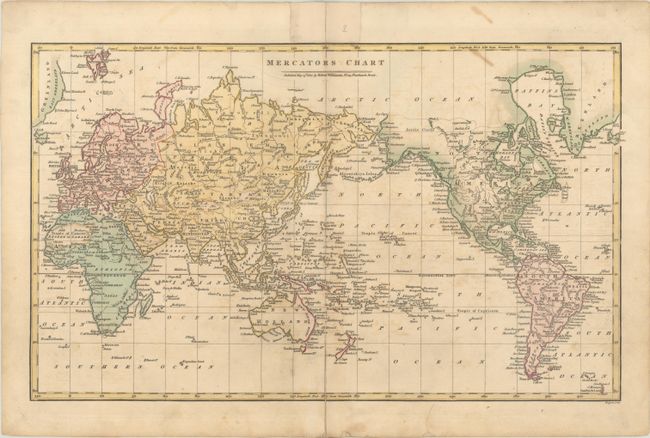
This attractive world map on Mercator's projection is centered on the Pacific Ocean and excludes both polar regions. In North America, the depiction of Alaska is fairly accurate up to the Icy Cape and virtually blank above the dotted line. The United States is shown east of the Mississippi River with a large Louisiana to its west and California is New Albion. Australia is divided between New South Wales and New Holland with an entirely blank interior. Engraved by Froggett.
References:
Condition: B+
There is light offsetting and a 3" fold separation at bottom that has been closed on verso with old paper.