Subject: California, Geology
Period: 1938 (dated)
Publication:
Color: Printed Color
Size:
73.8 x 84 inches
187.5 x 213.4 cm
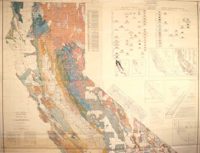
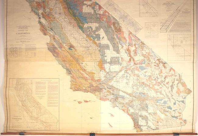
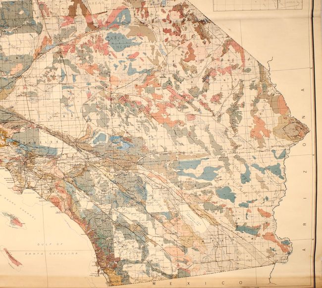
This colossal geological map of California was prepared by Olaf Jenkins, Chief Geologist of the Geologic Branch of the Division of Mines. Much larger than preceding geological maps of the state, it was issued on six sheets and joined. The map presents impressive geological detail through a combination of color and pattern, identifying 80 unique types on the map. The compiler was faithful to his data and notes those regions that had not yet been mapped, with the largest areas being around the Klamath Mountains and northern coast. The base map is derived from USGS data complied by A.F. Hassan from 1929 with highways and roads based upon the State Division of Highways and various automobile associations. A legend further identifies county seats, towns, faults, railroads, electric railroads and much more. The map is flanked by 8 insets, featuring the large "Geomorphic Map of California" at bottom left and an interesting "Glacial Map of Sierra Nevada." First edition. OCLC notes 4 locations for this edition.
References:
Condition: B+
A mostly clean and colorful example with light toning at lower left and a small puncture hole in the image at top left. There are small chips in the top blank margin, and the top roller is detached. An attractive example in very good condition considering its size.