Subject: Arizona & New Mexico
Period: 1881-1904 (published)
Publication:
Color:
The Southwest region was acquired by the United States at the end of the Mexican-America War in 1848 and became New Mexico Territory in 1850. Early attempts to gain statehood were quashed by the debates over slavery. During the Civil War, the original New Mexico Territory was split with the western part becoming the Arizona Territory. The Desert Land Act of 1877, which encouraged economic development in the Western states, resulted in a flood of new settlement into the territories. The maps in this lot provide an excellent view of the early development of these territories.
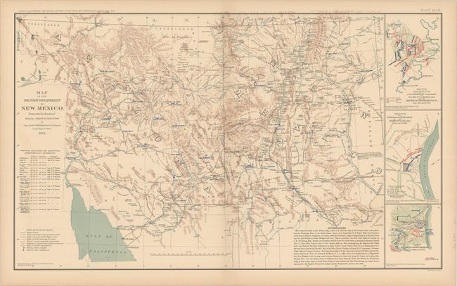
A. Map of the Military Department of New Mexico…, by U.S. War Department, from Atlas to Accompany the Official Records of the Union and Confederate Armies 1861-1865, dated 1864, printed color (27.3 x 16.6"). Plate XCVIII from this noted Civil War atlas is a fine map of New Mexico Territory with great detail throughout. The topography is shown via hachure and the waterways are in blue. The map locates army posts, villages and towns, military and explorers' routes, wagon roads, trails, arroyos, military posts (both occupied and abandoned), springs, passes, etc. A long legend presents an excellent reference to the map's sources. Three unrelated Civil War battlefield plans are inset at right, depicting the Battle of Chickamauga, the skirmish at Dardenelle, Arkansas, and the Battle of Shiloh. Dated 1864, but published in 1894. Condition: There is faint toning along the sheet's edges. (A)
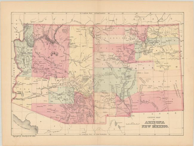
B. County Map of Arizona and New Mexico, by Bradley & Co., from Bradley’s Atlas of the World..., dated 1881, hand color (11.2 x 8.0"). Attractive small map of the territories showing early county development; Arizona has seven counties and New Mexico thirteen. The capital of Arizona is now relocated to Prescott. Condition: Light toning. (B+)
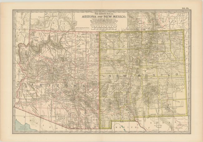
C. Arizona and New Mexico, by Matthews-Northrup Co., from The Century Atlas, dated 1897, printed color (14.9 x 10.4"). The remarkably precise engraving of this map shows the counties, Indian reservations, topography, roads, postal routes, railroads, cities, towns, and the progress of the public surveys. The capital of Arizona has finally landed in Phoenix. Condition: A short centerfold separation and edge tear both at bottom have been closed on verso with archival tape. (A)
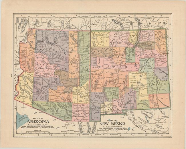
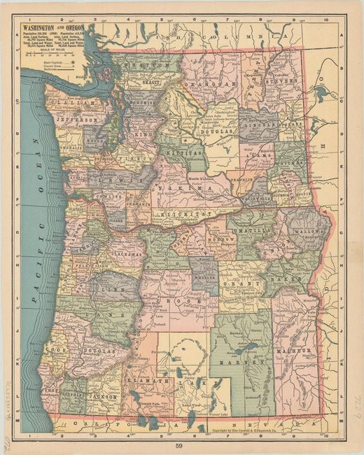
D. Map of Arizona / Map of New Mexico, by Crowell & Kirkpatrick Co., from The Peerless Atlas of the World, published 1904, printed color (11.5 x 8.9"). This handsome little map depicts the two territories at the turn of the twentieth century with nearly complete county structure. The burgeoning population is noted below each title with Arizona having 122,931 people and New Mexico a whopping 195,310 in 1900! A map of Washington and Oregon appears on verso. Condition: A short edge tear in the upper blank margin has been closed on verso with archival tape. (A)
References:
Condition:
See description above.