Subject: Upper Midwestern United States, Great Lakes
Period: 1835 (circa)
Publication: Comprehensive Atlas
Color: Hand Color
Size:
10.1 x 7.8 inches
25.7 x 19.8 cm
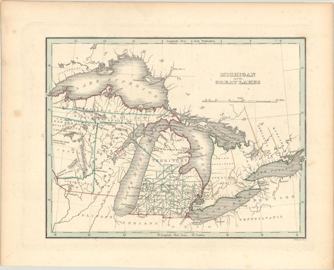
This is an interesting map of the Great Lakes regions during a period of rapidly changing boundaries in the old Northwest Territory. Present-day Wisconsin is shown as the District of Huron, attached to Michigan, a short-lived political division. Prior to 1828, Wisconsin was administered by Illinois and in 1836 became a separate territory. Outside of some early development in the southeast part of Michigan there is very little settlement shown. One of the more interesting notations is the "New York Mississippi Land Co.'s Tract, commonly called Carvers Tract." This region in the Dakotas was purportedly granted to Jonathan Carver by the Sioux Indians. It is shown on only a few maps of this period.
References:
Condition: B+
Contemporary outline color with very light foxing, marginal toning, and remnants of hinge tape on verso.