Subject: Eastern United States
Period: 1835 (circa)
Publication:
Color: Hand Color
Size:
12.6 x 10.8 inches
32 x 27.4 cm
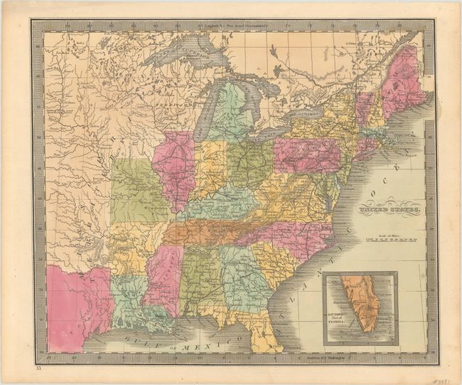
Map shows the extent of the early United States, with Missouri, Arkansas and Louisiana demarcating the western frontier. Texas is part of Mexico, a large Missouri Territory reaches westward, and Huron Territory takes the place of Wisconsin and the Upper Peninsula of Michigan. The southern tip of Florida is shown in an inset at the lower right. The map is filled with early towns, settlements and mines, watershed and some topography. Burr was appointed to be topographer to the U.S. Post Office Department in 1832 and was unable to complete the maps for his atlas. Thomas Illman assumed responsibility to complete the atlas, publishing it using the New York firm of D.S. Stone. In this state, Burr's name has been removed from the title and Illman's imprint has also been removed.
References:
Condition: B+
Full contemporary color on a light toned sheet.