Catalog Archive
Auction 184, Lot 166
NO RESERVE
"Railroad Map of the United States, Showing the Through Lines of Communication from the Atlantic to the Pacific. Together with the Various Steamship Lines Along the Seaboard", Mitchell, Samuel Augustus
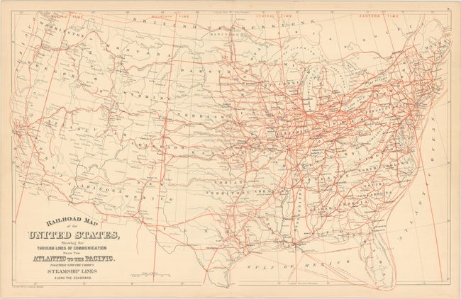
Subject: United States, Railroads
Period: 1880 (dated)
Publication:
Color: Printed Color
Size:
22.8 x 14.4 inches
57.9 x 36.6 cm
Download High Resolution Image
(or just click on image to launch the Zoom viewer)
(or just click on image to launch the Zoom viewer)