Subject: United States
Period: 1835 (circa)
Publication: A Comprehensive Atlas- Geographical, Historical & Commercial
Color: Hand Color
Size:
10.1 x 7.6 inches
25.7 x 19.3 cm
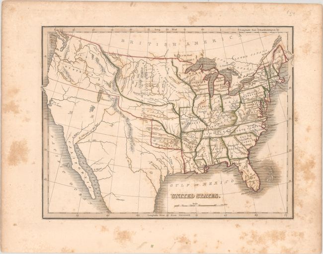
Map shows the extent of the early United States with Missouri, Arkansas and Louisiana demarcating the western frontier. Texas is part of Mexico and an unnamed Missouri Territory reaches westward including the Great American Desert where several Indian Districts are named. The Huron District takes the place of Wisconsin and the Upper Peninsula of Michigan. Oregon District takes in present-day Oregon and Washington and encroaches slightly into present-day British Columbia. An unnamed river links L. Timpanogos with the Pacific at the Bay of Sir F. Drake. The map is filled with early towns, settlements and mines.
References:
Condition: B
Contemporary outline color with foxing that is most prominent in the blank margins.