Subject: Northeastern United States & Canada
Period: 1843 (published)
Publication:
Color: Black & White
Size:
24.4 x 14.5 inches
62 x 36.8 cm
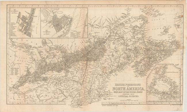
This very detailed map extends from Detroit, Lake Erie, Lake Ontario, and down the River St. Lawrence to its mouth. It shows the Gulf of Saint Lawrence to include Anticosti Island, the Magdalene Islands, and part of Newfoundland. In the U.S., the map shows all of Long Island, Martha's Vineyard, Cape Cod, etc. It is filled with information including towns and villages, canals, railroads, coastal details and more. A table in the area of Michigan is a "Reference for the Names of the Townships in Niagara District." Three insets: Plan of the City and Harbour of Montreal; Plan of the City and Harbour of Quebec; and a map of Newfoundland. Engraved by Charles Copley. Blank verso.
References:
Condition: B+
Issued folding and now flattened and backed with tissue to repair a couple of short edge tears at right. There is some scattered staining and a binding trim at right.