Subject: Colonial Eastern North America & West Indies
Period: 1730 (circa)
Publication:
Color: Hand Color
Size:
22.6 x 18.7 inches
57.4 x 47.5 cm
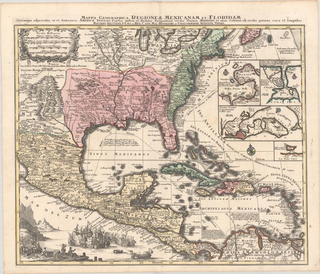
This is Mathias Seutter's decorative and beautifully engraved version of Delisle's important map of 1703 (Carte du Mexique et de la Floride). It provides a view of North America from the Great Lakes through the West Indies. The British colonies are confined east of the Appalachian Mountains, France controls the Mississippi valley and Florida, and Spain possesses Mexico. New Mexico is finely described with many native tribes and pueblos noted, including Acoma, Santa Clara, Isleta and more. While geographically is nearly identical to Delisle's chart, this map is very ornate; the lower left corner is filled with a huge sea battle and the upper left contains an attractive scale of miles cartouche. In the Atlantic are four inset plans of important trade centers in the Americas: Panama, Havana, Cartagena and Vera Cruz. Engraved by Tobias Conrad Lotter. Georg Matthias Seutter served an apprenticeship to J. B. Homan prior to setting up his own map publishing business in Augsburg. Many of his maps have a strong resemblance to Homann's maps.
References: Martin & Martin, p. 93, plt. 18.
Condition: A
A crisp impression on a bright sheet with a few faint spots at right.