Subject: Northeastern India & Bangladesh
Period: 1726 (circa)
Publication: Oud en Nieuw Oost-Indien
Color: Hand Color
Size:
21.6 x 17.7 inches
54.9 x 45 cm
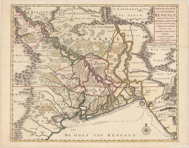
The Kingdom of Bengal is minutely illustrated on this fine map. It shows the Ganges Delta with its important farming districts, cities, and roads and shows the locations of several Dutch forts. Francois Valentyn was an important historian of the Dutch East India Company [V.O.C]. In the preparation of his Oud en Nieuw Oost Indien, Valentyn was given access to the secret V.O.C. archives, which enabled him to include previously unavailable information on important earlier Dutch voyages. The map is based on the work of Johan van Leenen, who made the first accurate survey of the eastern Bengal delta in 1666. It was drawn and engraved by Jan van Braam and Gerard onder de Linden.
References: Shirley (BL Atlases) G.VALN-1a #45.
Condition: A
A sharp impression issued folding, now flat, with a chip in the blank margin that has been repaired with archival materials.