Subject: Eastern, Southern & Southeast Asia
Period: 1781 (dated)
Publication:
Color: Hand Color
Size:
25.9 x 24.8 inches
65.8 x 63 cm
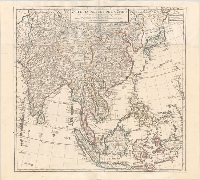
This large, attractive map covers the vast region extensively explored by the Europeans with particular emphasis on the trade routes on the mainland and the islands of the Philippines and the East Indies. In Japan, Hokkaido (Terre d' Yeco ou d'Eso) is attached to the Asian mainland, and the Sea of Japan is named Mer Orientale ou Mer de Coree. Terre de la Compagnie appears in the border at top right. Korea is correctly shown as a peninsula, although much too wide. The mythical Lac de Chaamay appears in present-day Burma with several rivers flowing south. The map is filled with details of towns, roads, rivers, and topography. This is a later edition of the map, published after Dezauche acquired Delisle's plates following Buache's death in 1773. Two sheets, joined, as issued.
References:
Condition: A
A nice impression on paper with the watermark of a Maltese cross encircled in rosary beads. There is a tiny tear at the fold junction and faint dampstaining along the bottom edge that is barely visible on recto.