Subject: Eastern Mediterranean & Middle East
Period: 1654 (dated)
Publication:
Color: Hand Color
Size:
20.1 x 13.4 inches
51.1 x 34 cm
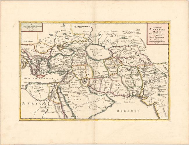
This striking map shows the extent of Alexander the Great's conquests between his homeland in Macedonia through the Persian Empire and northern Africa. It spans from the Balkans, Eastern Mediterranean, and Northern Africa east to the Ganges River. Several place names appear throughout the map, including Pella, Babylon, Jerusalem, Persepolis, and Bactra. There is excellent topographical detail, especially covering the major rivers and mountain ranges. The Caspian Sea is depicted as an oval. A decorative title cartouche adorns the top right corner. Engraved by Jean Somer. Dated 1654 but published in 1667 by Pierre Mariette.
References: cf. Pastoureau, DUVAL II B [114].
Condition: A
A sharp impression with contemporary outline color and later color in the cartouche, on a bright sheet with a large coat of arms watermark. There are a couple of minor spots and several faint dampstains along the edges of the sheet.