Catalog Archive
Auction 183, Lot 415

"Antiquorum Illyrici Orientalis Espicopatuum Geographica Descriptio", Tavernier, Melchior
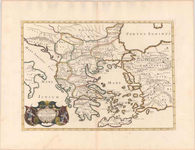
Subject: Greece

Period: 1640 (dated)

Publication:

Color: Hand Color

Size:
19.9 x 14.1 inches
50.5 x 35.8 cm
Download High Resolution Image
(or just click on image to launch the Zoom viewer)

A strongly engraved map of ancient Greece and part of Turkey extending from the Black Sea to Crete. The map is filled with classical place names, including the Athenae, Hadrianopolis, Megara, and Aphrodisias. The dramatic cartouche is flanked by two warriors. Dated 1640 but published in 1667.

References:

Condition: A

A sharp impression with contemporary outline color and later color in the cartouche, on a bright sheet with a large coat of arms watermark. There is marginal soiling, an archivally repaired tear in the bottom blank margin, and a hint of toning along the centerfold and edges of the sheet.

Estimate: $200 - $230

Sold for: $550

Closed on 6/9/2021

Archived