Subject: Northern France
Period: 1603 (published)
Publication: Theatrum Orbis Terrarum
Color: Hand Color
Size:
19.4 x 15 inches
49.3 x 38.1 cm
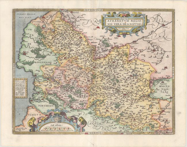
This decorative map of Artois is the first of three maps of the province that Ortelius included in the Theatrum. The map is based on the manuscript map Jacques Surhon made in 1554. For security reasons it was not published until 1579, when Antwerp had been independent for a short time. The map is filled with extensive detail of the rivers, forests, cities, fortifications and villages, and is richly embellished with two large cartouches. This is the second state with a dedication replacing a ship in the ocean. Latin text on verso.
References: Van den Broecke #72.
Condition: A
A sharp impression on a clean, bright sheet with some minor paper weakness in the right blank margin that has been professionally reinforced on verso.