Subject: Europe
Period: 1699 (dated)
Publication:
Color: Hand Color
Size:
23.3 x 18.3 inches
59.2 x 46.5 cm
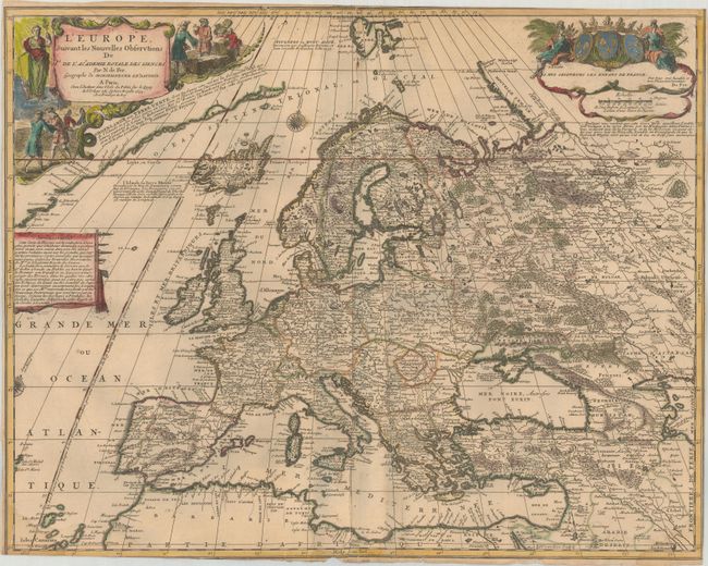
This densely engraved map of Europe extends east to the Caspian Sea and south to North Africa. A partial coastline of Greenland appears adjacent to the title cartouche along with a short note on the discovery of the coastline. Several additional notes are scattered throughout the map. One line of longitude is shown running through Isle de Fer with a notation that it serves as the prime meridian based on a decree by Louis XIII in 1634. Adorned with two lovely cartouches featuring allegorical figures, merchants and the coat of arms of the Kingdom of France. Engraved by N. Guerard.
References:
Condition: B
A nice impression with contemporary outline color in the map and later color in the cartouches, on a watermarked sheet. There is light toning, several dampstains along the edges of the sheet, extraneous creases along the centerfold, and 5 small holes in the image, two of which have been repaired on verso with old paper. The sheet has been trimmed on all sides, with some loss of neatline at bottom left and top right, and there are some tiny tears and chips along the edges of the sheet.