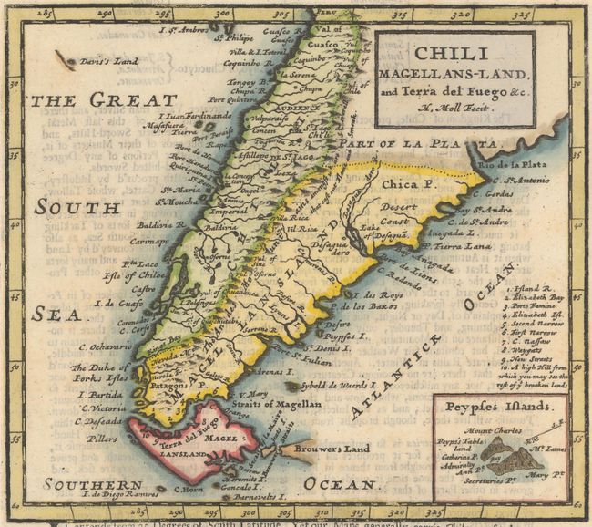
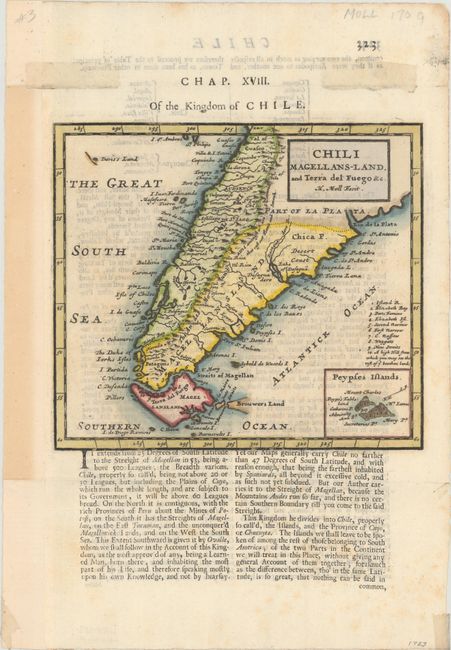
Subject: Southern South America
Period: 1701 (published)
Publication: A System of Geography...
Color: Hand Color
Size:
7.3 x 6.4 inches
18.5 x 16.3 cm
This detailed copper engraved map shows the southern tip of South America with Tierra del Fuego, Le Maire Strait, and a partial outline of the Falkland Islands. It includes an inset of the fictitious Peypses Islands and a numbered table of locations along the Strait of Magellan. Decorated with a simple block style title cartouche. On a full sheet of English text measuring 8.8 x 12.6".
References: Shirley (BL Atlases) T.MOLL-1b #41.
Condition: A
A dark impression on watermarked paper with minor text show-through, a few faint spots, and remnants of hinge tape in top blank margin on recto. The left margin has been extended to better accommodate framing.