Subject: Gulf of Mexico & Caribbean
Period: 1598 (published)
Publication: Theatrum Orbis Terrarum
Color: Hand Color
Size:
19.7 x 14.1 inches
50 x 35.8 cm
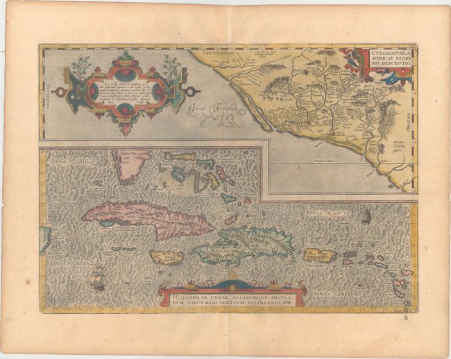
Two great early maps of important regions in the New World are combined into this interesting composition. The first covers the region of western Mexico around Culiacan and the Spanish settlement of Villa S. Michael's, the region noted for its silver mines. The second is the first detailed map of the Greater Antilles with detail in southern Florida, the Bahamas, and the Caribbean that is quite remarkable for the period. Ortelius based the maps on a variety of sources including Mercator’s world map (1569) and other maps by Guttierez and Alonso De Santa Cruz. Three strapwork cartouches and sailing ships decorate the map. French text on verso.
References: Van den Broecke #14.
Condition: B+
A dark impression on a lightly toned sheet with a horn watermark and light printer's ink residue. An old manuscript page number is in bottom blank margin.