Subject: Texas, Gulf Coast
Period: 1881-99 (dated)
Publication:
Color: Black & White
Six charts showing the development of the Gulf Coast (with an emphasis on Texas) in the latter part of the 19th century:
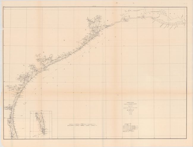
A. Sketch Showing the Progress of the Survey in Section No. IX from 1848 to 1881, by U.S. Coast and Geodetic Survey, dated 1881 (36.9 x 26.7"). Presents the extent of survey work along the Gulf Coast from Laguna Madre to Vermilion Bay in Louisiana.
B. Progress Sketch Sec. VIII-IX from the Mississippi River to Galveston, by U.S. Coast and Geodetic Survey, dated 1885 (41.7 x 15.5). Shows the extent of surveys along the Gulf Coast from Galveston Bay to the mouth of the Mississippi River, with an inset of the Rio Grande.
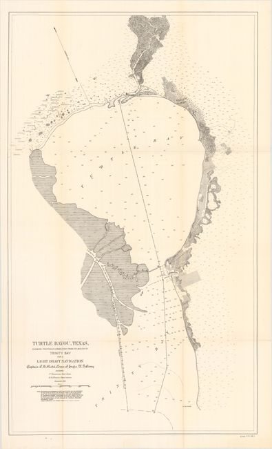
C. Turtle Bayou, Texas, Showing Proposed Connection from Its Mouth to Trinity Bay for a Light Draft Navigation, by U.S. Corps of Engineers, from H.R. Doc. 440, 56th Congress, 1st Session, dated 1899 (20.8 x 35.0"). Depicts Turtle Bay (now Lake Anahuac) with soundings and topographical detail. The town of Anahuac is named. Details parts of the planned inland light draft navigation system.
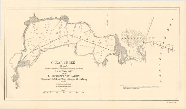
D. Clear Creek, Texas. Showing Proposed Connection from Its Mouth to Galveston Bay for a Light Draft Navigation, by U.S. Corps of Engineers, from H.R. Doc. 449, 56th Congress, 1st Session, dated 1899 (21.5 x 11.4"). Focuses on Clear Creek and Lake, with a street grid of Seabrook. Details parts of the planned inland light draft navigation system.
E. Dickinson Bayou, Texas, Showing Proposed Connection from Its Mouth to Galveston Bay for a Light Draft Navigation, by U.S. Corps of Engineers, from H.R. Doc. 448, 56th Congress, 1st Session dated 1899 (20.6 x 12.3"). Shows a portion of North Galveston's street grid. Details parts of the planned inland light draft navigation system.
References:
Condition:
All charts are issued folding and are in A or B+ condition with some light toning along the folds and occasional short fold separations.