Subject: Texas
Period: 1862 (circa)
Publication:
Color: Hand Color
Size:
24.7 x 16.8 inches
62.7 x 42.7 cm
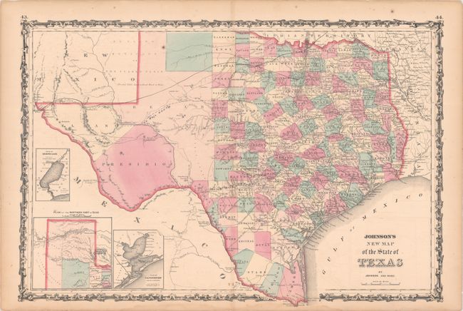
Large, handsome map with county development mostly in eastern Texas and only the three large counties of El Paso, Presidio, and Bexar in the west. The panhandle, noted as the Staked Plain (Elevated Table Land, without Wood or Water), includes a large section that is unorganized. There are numerous wagon roads, a few completed railroads, and the US Mail Route traced on the chart. Insets include a Plan of Sabine Lake, Plan of the Northern Part of Texas, and Plan of Galveston Bay. Surrounded by a decorative scrollwork border. Blank verso, published 1862-63.
References:
Condition: B+
There are some light scattered spots, dampstaining in the bottom margin, toning along the edges of the sheet, and short centerfold separations at top and bottom that have been closed on verso with archival tape.