Subject: Nantucket, Massachusetts
Period: 1848 (dated)
Publication:
Color: Black & White
Size:
17.2 x 14.1 inches
43.7 x 35.8 cm
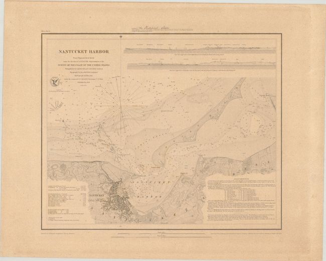
This detailed nautical chart covers Nantucket Harbor. The waters are filled with soundings, bottom types, rocks, buoys, and other navigational information. A table at bottom left includes notes on the tides, and extensive sailing directions appear at bottom right. The town is shown in plan form, and there is nice topographical detail along the coasts. Coatue Beach is named. There are two views across the top that were drawn by J. Robertson and engraved by O.A. Lawson. From the trigonometrical survey under the direction of A.D. Bache, Superintendent of the Survey of the Coast of the United States. Triangulation by Bache and C.M. Eakin, topography by H.L. Whiting, and hydrography under the command of C.H. Davis. Reduced by J.M. Wampler. Topography engraved by F. Dankworth and O.A. Lawson, with assistance from J.H. Young. Lettering by J. Knight and W. Smith. This is a very early example printed on heavy paper and appears to have been a special copy presented to the "Pontifical States," as written in manuscript above the map. Also known as the Papal States, the Pontifical States were territories in Italy under the sovereign rule of the pope, originally established in the 8th century. The United States officially established diplomatic relations with the Pontifical States in August 1848, around the time of the map's publication date.
References:
Condition: B+
On a thick, sturdy sheet with light toning and scattered foxing.